Dharmatel4 (talk | contribs) No edit summary |
Dharmatel4 (talk | contribs) |
||
| Line 42: | Line 42: | ||
* A cluster of 5 between these and on the Northern side of the main road. The Northernmost building seems to be the termination for the Northwestern tunnel. |
* A cluster of 5 between these and on the Northern side of the main road. The Northernmost building seems to be the termination for the Northwestern tunnel. |
||
* A larger lone structure to the East |
* A larger lone structure to the East |
||
| − | * A large circle with a dot in centre to the East. |
+ | * A large circle with a dot in centre to the East. Some smaller items are also visible. |
| − | Some smaller items are also visible. |
||
==The Flame== |
==The Flame== |
||
Revision as of 00:52, 17 December 2007
Enhanced version of the map showing the Flame ("Enter 77")
Promotional still showing the full map

Enhanced version of the map from the Promotional still
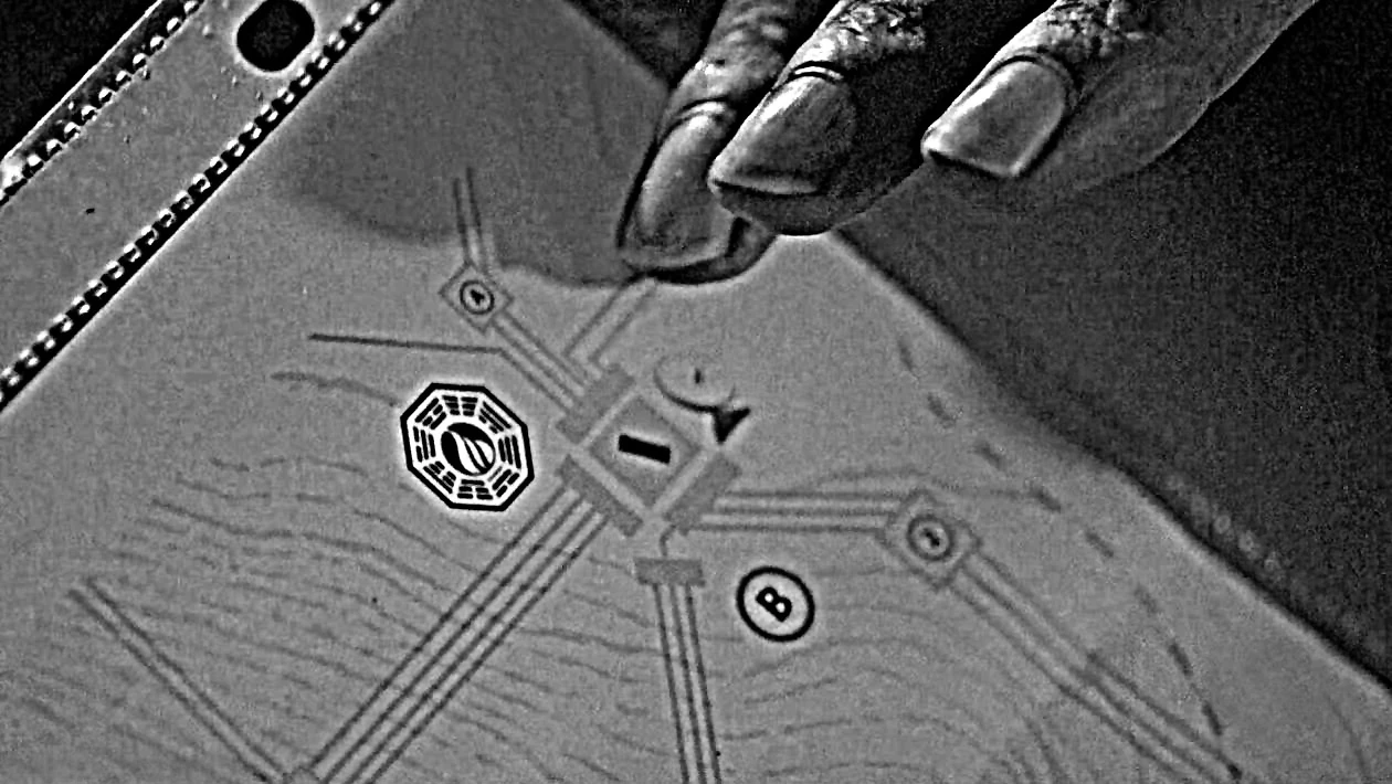
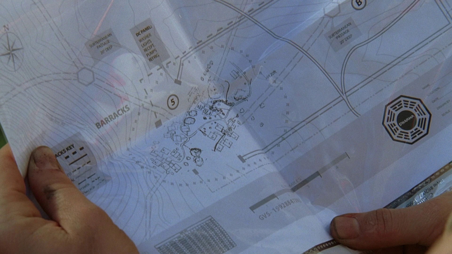
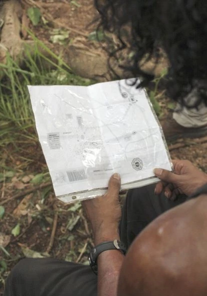
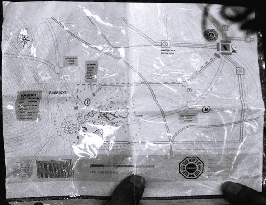
The DHARMA cabling map is the map that Sayid finds in the DHARMA Operations Manual ("Enter 77"). It shows the Flame station as a central hub for the cables, one of which leads to an area called the barracks which he believes is where the Others are staying. Cable relay/switching points are also shown, along with the station's satellite dish. A circled "5" appears near the Barracks area. A circled "B" appears in the region around the flame. Note: The B appears much further South in the full map released as a promotional still.
A key on the map near the barracks labels the following items:
| “ |
DC PANEL: |
” |
Two other keys refer to subterranean passages. They mark two passages leading from the barracks. One leads to the Flame. Where the other leads to is undetermined.
| “ |
PASSAGE 20' DEEP |
” |
It does not appear that the subterranean passages are colocated with the electrical or other services.
Subterranean conduit
According to the map, there are four passages leading from the barracks to areas beyond the sonic barrier. Two are marked as being subterranean. The other two are not. Of the passages marked as subterranean:
- One leads from the barracks to the Northwest, then splits off after about 3.5 miles at a point "20' deep". This split is a hexagon on the map just outside the sonic fence and might be a hatch or room. One branch heads North and another heads West.
- The second exits just North of East with another hexagon about 4.5 miles away, again outside the sonic barrier. This passage leads to the Flame.
Of the passages not marked as subterranean:
- One exits to the Northeast, and again leads to the Flame.
- The second exits just South of West and splits immediately before the sonic barrier with one branch heading North, intersecting and crossing the West split of the Northwest tunnel, and another heading Southwest.
Electrical service
The Flame apparently supplies electricity to the barracks and other locations on the island. The cabling map shows the following connections from the Flame:
- A Northern "hub" has 5 lines, one splitting to the Northwest, two run to a square (labeled "A" and possibly a "switch box") then North by Northeast, and two splitting directly East, and through another switch box, with one line heading North and two continuing East.
- A Southern "hub" has 4 lines, three of which run Southeast to a switch box similar to "A" above then South and West to the South side of the barracks, and one of which connects to another "hub" with three lines running Southwest to another switch box before turning West to serve the North side of the barracks.
- A Western "hub" has 4 lines which run directly to the West before hitting another square labeled "switch box" with two running North.
The barracks appear to be serviced with electricity ("DC PANEL") from two points: one is on the North side of the village and another is on the South. Both lines appear to lead directly West, with the Northern one intersecting with another service of some kind at a square point (numbered "7") more than 5 miles from the Barracks.
The Barracks
The village where the Others reside is shown in some detail. It appears that there are 18 structures arranged roughly as follows:
- A cluster of 6 structures on the Western side. One building seems to be the termination for the Western tunnel.
- Another cluster of 6 on the Southern side. The Easternmost building seems to be the termination point for the Eastern tunnel.
- A cluster of 5 between these and on the Northern side of the main road. The Northernmost building seems to be the termination for the Northwestern tunnel.
- A larger lone structure to the East
- A large circle with a dot in centre to the East. Some smaller items are also visible.
The Flame
The Flame logo is used, as are some Contour lines indicating a change in elevation to the West. A dotted line is present to the Southeast. The river where Rousseau waited in "Enter 77" is not indicated on this portion of the map, even though it is apparently quite close to the Flame.
Other facts
- The road map is clearly marked with a C in a circle, the cabling map is marked with a B in a circle.
See also